Kotor Montenegro
Europe´s bigest motorhome-portal
from motorhome drivers for motorhome driver
start
Kotor, Information and images
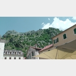
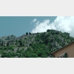
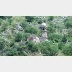
- 64 km² of the mountain massif between Kotor and Cetinje are designated as a national park.. The highest peak, the Stirovnik 1749 m is a restricted military area and can not be climbed.. <9> <9> From Kotor, 32 tight turns meander to the Krstac pass.. <9> After a few kilometers Njegusi is reached.. Here you can visit the birthplace Petar II or taste the high-quality ´njeguski prsut´ or the medium-hard cheese ´njeguski sir´ and buy it directly from the grower.. <9> <9> <994/1691349> <994/1691348> <994/1691347> <9> <9> Through karst mountains leads the road, which should be better traveled by scooter or moped than with the WOMO, to the Mausoleum at Jezerski vrh.. <9> <9> It is also possible to walk from Njegusi to the mausoleum.. The easy mountain hike with a height difference of 800 m and a distance of 7.5 km can be mastered in just 3 hours (easy).
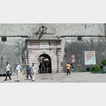
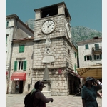
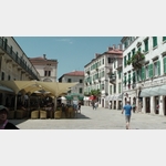
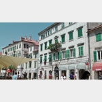
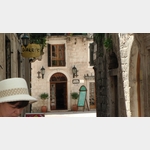
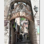
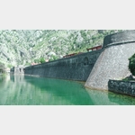
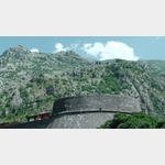
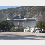
1686843 - On the southeastern shore of Boka Kotorska Fjord, the town of Kotor lies at the foot of Lovcen.. The city is surrounded by a 5 km long, up to 20 m high and 2 to 15 m wide city walls.. Many lengthy battles against the Turks and Napoleon and two earthquakes (1667 and 1979) made the city hard to come by and it is remarkable how this small town managed to preserve its cultural and historical monuments.. <9> <9> <994/1690442> <994/1690445> <994/1690443> <9> <9> You can get into the old town through the north, south or harbor gates.. From the Morska Vrata (Port Gate), built in 1555, you get to the Trg od Oruzja.. Here is also the 1602 built clock tower, which served as a dungeon.. <9>
1688683
 | Town
Kotor
Kotor, located at the south-eastern tip of the Kotor Bay, was decisively shaped by the Venetians.
The city was badly hit by an earthquake in 1979, but was rebuilt by 1989 thanks to support fro. . . FURTHER . . .
 [000.35]


-
Motorhome place

 85339 Kotor Montenegro
Pay for use site 20 Euro


")


open 1.Januar until 31.Dezember


Motorhome place
 85330 Kotor Montenegro
without charge


open Januar until Dezember

Motorhome place
 85330 Kotor Montenegro
Pay for use site 30 Euro

open Januar until Dezember
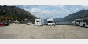
Motorhome place Kotor Busbahnhof
85330 Kotor MontenegroPay for use site 20 Euro

open 1.Januar until 31.Dezember
Motorhome place
 85330 Njegusi Montenegro
without charge
open Januar until Dezember
Motorhome place Aire Kotor
85339 Kotor MontenegroPay for use site 20 Euro

open 1.Januar until 31.Dezember
 Selected parking spaces
 | general parking lot
Parkplatz kaljari 2
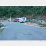
montenegro 85330 Kotor kaljari 2Very well located parking and overnight place to visit the old town of Kotor.
 | Picnic parking area
Picknickplatz
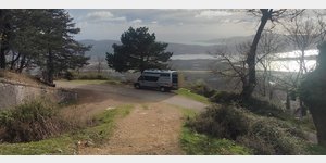 85339 Odoljen
 Picnic place at Fort Vrmac with a great view
 | Parking lot cemetery
Parkplatz am
montenegro 85339 Kotor Put prvoboraca
| general parking lotAllgemeiner Parkplatz
montenegro 85339 Kotor
| Picnic parking areaPicknickplatz mit Informationsstand
montenegro Velji Bostur
 | Parking suitable for campers over 5 m
Parkplatz, kein Wohnmobilverbot
montenegro 85320 Mr%u010Devac Aerodromska
Selected sights
 | Cultural History
Bucha Palace
montenegro 82000 Tivat Njegoeva
Das Bucha Palace in Tivat ist ein historisches Gebäude, das heute als Museum genutzt wird. Es wurde in der zweiten Hälfte des 19. Jahrhunderts erbaut und ist ein Beispiel für die Architektur des Klass. . . FURTHER . . .
Das Bucha Palace in Tivat ist ein historisches Gebäude, das heute als Museum genutzt wird. Es wurde in der zweiten Hälfte des 19. Jahrhunderts erbaut und ist ein Beispiel für die Architektur des Klass. . . FURTHER . . .
 | building
Njegos Mausoleum
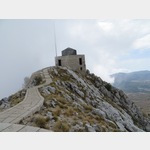 Montenegro 81250 Centinje R13
The highest mausoleum in Europe is located on the Jezerski vrh (1657m) in the Lovcen Mountains.
It was built by the sculptor Ivan Mestrovic and is the burial place of the ruler and poet Petar Petr. . . FURTHER . . .
 | Hiking
Bergtour auf den Jezerski Vrh
Montenegro Cetinje
The tour leads from the approx. 1250 m high pitch to the 1657 m high mountain to the mausoleum of the poet prince Petar Petrovic Njegos. The tour can be classified as easy.
total distance: around 10 km
walking time: around 2:45 h
The tour leads from the approx. 1250 m high pitch to the 1657 m high mountain to the mausoleum of the poet prince Petar Petrovic Njegos. The tour can be classified as easy.
total distance: around 10 km
walking time: around 2:45 h
Selected service points
 | public water point fountain spring
Quelle
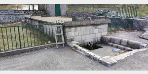 montenegro Ivanova korita Cetinje - Lov&!263
Frisches Bergwasser, kein Schlauchanschluss möglich
 | Gas exchange
INA
montenegro 85320 Tivat Jadranska Magistrala
Gas bottles can be filled here
Gas bottles can be filled here
 | Laundromat
Waschsalon beim Suoermarkt, gute Parkmöglichkeit
montenegro 85330 Dobrota
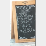
Selected gastronomy
 |
| SILVER MOON
montenegro 85330 Dobrota
motorhome places Kotor in these books
General Pois
 | hospital
Mansa Medica
montenegro 82000 Tivat II. Dalmatinske
Vielen Dank für die Präzisierung. Tatsächlich habe ich Informationen zu einer medizinischen Einrichtung namens "Mansa Medica" in Tivat gefunden.Mansa Medica ist ein modernes medizinisches Zentrum in T. . . FURTHER . . .
Vielen Dank für die Präzisierung. Tatsächlich habe ich Informationen zu einer medizinischen Einrichtung namens "Mansa Medica" in Tivat gefunden.Mansa Medica ist ein modernes medizinisches Zentrum in T. . . FURTHER . . .
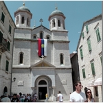
 | church
Sv. Luka
 Kotor
Kotor The Church of St. Luka (St. Luke) in Kotor in Piazza Greca square has features of both Romanesque and Byzantine architecture. This church is the only building in the city that did not suffer significa. . . FURTHER . . .
 | Kathedrale
Sv. Tripun
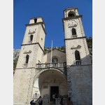 Montenegro 85330 Kotor Ulica 2
Since Andrija Saracenis acquired the relics of St. Tripun from the Venetians, construction of a cathedral began in 809. The Romanesque cathedral was begun in 1166.
Inside the basilica, which is 35. . . FURTHER . . .
 | castle
Festung Sveti Ivan
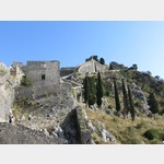 Montenegro 85330 Kotor Road to the Fort of St Ivan
 1426 steps lead to the fortress of Sv. Ivan. The strenuous climb is rewarded with a magnificent panoramic view of the Bay of Kotor.
 | Ferry
Faehre
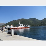 montenegro , Donja Lastva Jadranska Magistrala
Ferry Kamenari-Lepetane
The ferry saves you around 100 km around the Bay of Kotor
Operating hours: continuously 5.00-24. 12:00 p.m.| every hour 24.00-5. 12:00 a.m