
Europe´s most comprehensive motorhome portal
Over 15 years of experience and quality
by camper drivers for camper drivers


Over 15 years of experience and quality
by camper drivers for camper drivers
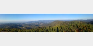
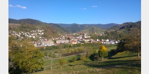
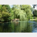
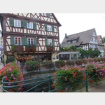
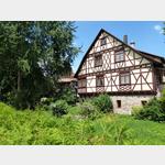
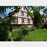
landscape pictures
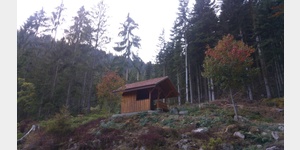
Camping and RV parks
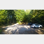
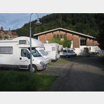
Mooswaldparkplatz


000 km | Hikers´ parking lot, secluded and quiet in the high forest. No distant view. Starting point for hikes. The Kalikut mountain restaurant is located nearby.
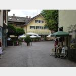
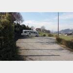
Lautenbach


005.74 km | A parking space next to the sports grounds directly on the Rench. @The courts are 5 meters wide. If there is not enough space, a neighboring parking space can be used. @The parking ticket machine only takes coins. It is also possible to purchase a weekly ticket. The parking ticket must be placed behind the windshield. @The KONUS guest card, which, among other things, allows free travel on public transport in the Upper Black Forest, can be obtained at the following locations: Hotel Sonnenhof, Gas...
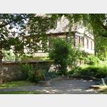
Wohnmobil-Stellplatz neben dem Freibad.

006.93 km | During May-September there is a barrier-free toilet and barrier-free shower in the leisure pool. @Payment is made via machine at the entrance, separate dailyweekly rates are also posted here@The place itself is free of charge but tourist tax must be paid.
Platz am Renchtalstadion
007.88 km | very nice place right on the banks of Rench (but without a view of the water, because the embankment is too high) @ the machine only works with coins and EC card. @Because of the Oberkirch Wine Festival, the mobile home parking space can only be used to a limited extent in the week before and after the first weekend in September. i.e. there is no possibility of supply and disposal during this time
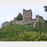
Seeburg castle
008.04 km | Forest car park at the foot of the Schauenburg. Simple space with 4 small power columns. Illuminated at night. Great view to Strasbourg. Very quiet at night, otherwise only visitors to the castle. The castle restaurant is closed on Mondays, except on public holidays.
Brandstetter Kappelle
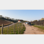
008.17 km | Hikers´ car park on a small pass between Oberkirch and Durbach. Wine-growing region. Especially in Durbach there are many renowned wineries and small schnapps distilleries. After a short hike through the vineyards, you can come to Staufenberg Castle in Durbach (restaurant, chocolate shop, view). @The space is very small and offers MAXIMUM ONE LEVEL FOR 1 TO 2 WOHMBOILE. He has a great view! In the evening hours the traffic decreases significantly.
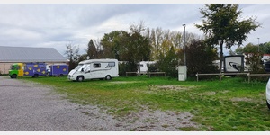
Nordrach
008.29 km | Simple flattened parking space for 6 mobiles with 8 power connections next to the Hans-Jakob-Halle and the cemetery. @The place itself is free of charge, but from the 2nd day there is a 1.70 europerson tourist tax @The place is steep. Wedges are necessary. @on the other side of the cemetery behind the church there is a parking lot for cars and buses. There is the supply, disposal station. @various fruit distilleries are located on signposted hiking trails
Ver-/Entsorgung Nordrach
008.39 km | Saarfürst brewery restaurant nearby, Saar cycle path. @ Pitches in an area separated by a barrier at the bathroom´DAS BAD´.. For the key for the barrier and the VE station ⬠50, - deposit are required.. Fee and security deposit are payable at the cash desk of the bath.. Electricity is included, supply, disposal costs per process (water drain, toilet / greywater empty) ⬠1, - (by chip - to buy at the bathroom cash register) @@ On the site there is a brasserie (with on site brewed beer) an...
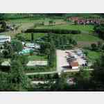
Camping Traiermühle


009.21 km | A small campsite on the B28.
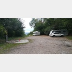
Wohnmobilstellplatz
009.74 km | Very quiet car park at the Huber Winery, with Strauss economy (Eichberg ostriches) right in the vineyard. Some courses can also be used by campers for an overnight stay, preferably in consultation with the winery. {line} By Gengenbacher Ortste
Youtube videos from the area


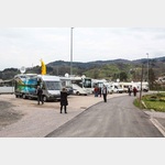
Parking spaces
 | Public car parking lot
004.78 km | Parking lot only for carsRamsbachacher Strasse car park on the B28, Ramsbach, Germany
Worth seeing

 | Lotharbrunnen
000.98 km | FountainDeutschland 77787 Nordrach Bärenweg
See image

 | Moosturm
002.31 km | observation towerDeutschland 77787 Nordrach
The tower was erected on the 871 m high Mooskopf by the Black Forest Association in 1890

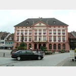
 | Lothardenkmal
002.77 km | monumentDeutschland 77787 Nordrach Siedigkopfweg
Monument to the great storm Lothar, which devastated large parts of the forests in this area on December 26, 1999

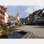
| Moosbrunnen
002.85 km | FountainDeutschland 77728 Oppenau Grenzweg
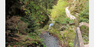
 | Wasser rinnt etwas langsam
003.81 km | Water / Sourcedeutschland 77704 Oberkirch Sportplatzstraße
public routes and books
Stellplatzführer: Deutschland: Der Rhein vom Bodensee bis zur Nordsee
Deutschland, Badische Weinstraße
Schwarzwald Rundreise
Copyright © 2023 - meinwomobuch.com
listed in the mobile home parking space database of meinwomo
listed in the mobile home parking space database of meinwomo