
Europe´s most comprehensive mobile home portal
Over 15 years of experience and quality
by camper drivers for camper drivers


Over 15 years of experience and quality
by camper drivers for camper drivers
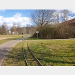
Rundweg zur Autobahnbrücke
Tour / hiking / bike / ski / Hiking
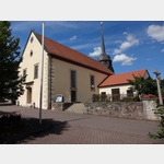
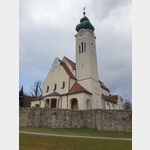
We park in the parking lot in front of the church. Even a large mobile home can easily park there for a walk.
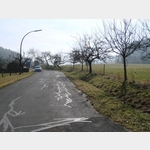
We walk down Schulstrasse to the crossroads. There we turn left into Oberzeller Straße. After about 500 meters we pass a Mariengrotte.
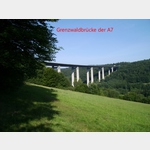
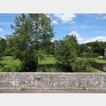
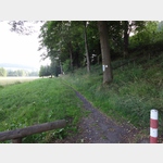
Shortly before the mighty motorway bridge, an initially asphalted path leads to the right down to the small Sinn.
The path leads over the creek on a boardwalk. to the opposite side of the valley. Here we choose the path to the right again up the valley. After approx. 500 m, the path crosses another fish water coming from the left and continues directly along the main arm of the narrow Sinn.
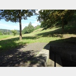
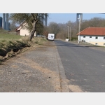
At a weir where part of the sense branches off laterally to the right as a fish water along a fish pond, leads again a bridge over the main arm. We continue straight ahead on the now asphalted path, cross Oberzeller Straße again at the crossroads and after a hundred meters on Schulstraße we arrive back at our parking lot.
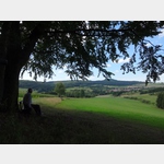
On the way, attentive observers will see many trees gnawed or gnawed by beavers. In addition, we learn a lot of interesting things about plants and animals on streams and rivers on several illustrated information boards along the way. On the way we also pass three benches on which we can sit comfortably. We are also welcome to get closer to the fish pond to look at the water lilies.
Note: The tavern anchor in the very well-kept ´Gasthof zum Biber´ located in the center of the village shows a beaver. However, the name of the inn does not derive from our hard-working beavers on the Sinn, but from the family of the Lords of Bibra. Heinrich von Bibra allowed the construction of this inn more than 200 years ago and immediately gave it his name.
Description of the tour
Route siehe obige BeschreibungNumber of tour points = 126
Total length of the tour = 2.23 km
Height difference = 21.87 m
Minimum height = 353.2 m
Maximum height = 375.07 m
contour line:

ADDRESS
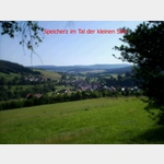
97786 Motten - Speicherz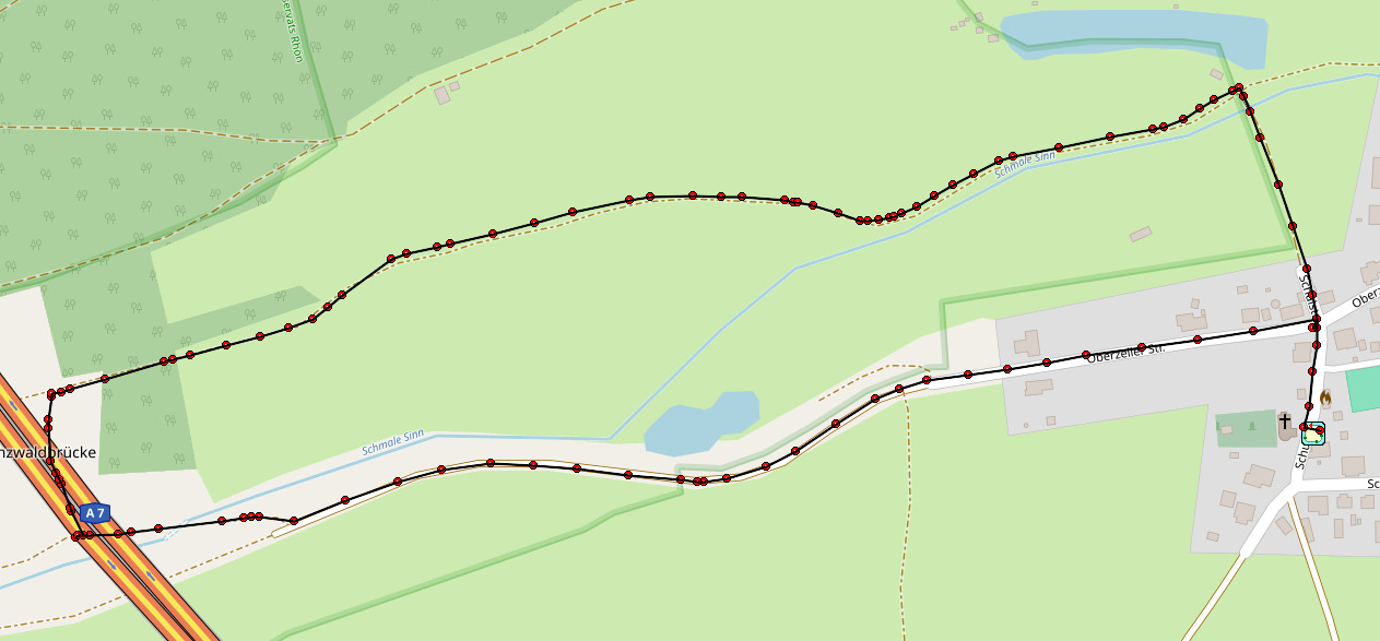
Click for interactive map
..
Images from Poi and starting point surroundings
.
Things worth seeing around the starting point
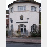
Kirche
St.[ click for more information ]
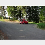
Parkplatz Oberzeller Straße 14
 Ca.
Ca. [ click for more information ]
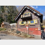
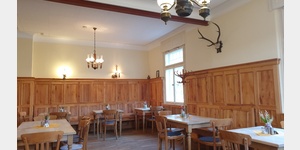
Gasthof zum Biber
Large country inn with cultivated home-style cooking.[ click for more information ]
Parkplatz, auch zum Übernachten
 Wide asphalted remnant of the former main road (dead end)
usable January - December
[ click for more information ]
Camping Rhoenperle
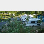 Accepts ACSI Card
 open 1 April - 30 October
[ click for more information ]
Aussichtsturm Mottener Haube
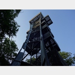 The approx.
 [ click for more information ]
ParkenPkw
 Small, slightly sloping hiking car park for approx.
 [ click for more information ]
Wanderweg Haubentour Rhön
 A 20 km long hiking trail over the Rhön
[ click for more information ]
Marienkirche
 Catholic bath church built around 1908
[ click for more information ]
WC Parkhaus
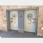 left at the exit by the ticket machine
[ click for more information ]
Cafe Hexenhäuschen
 Rustic house with a small beer garden, cafe and hot meals Opening times: Wed-Sun, 9:00 a.m.
 [ click for more information ]
Haus Löwe
 ´Haus Löwe´ inn with beer garden
[ click for more information ]
WC Washington Platz
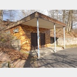 Toilet house on the hiking trail
[ click for more information ]
WC Kirham Weg
 is somewhat hidden behind bushes
[ click for more information ]
WC im Kurhaus
 Toilet in the Georgi Kurhaus, side entrance
[ click for more information ]
Touristeninfo im Kurhaus
 Tourism office in the Kurhaus
[ click for more information ]
von Bad Brückenau zum Aussichtturm Dreispitz
 - Circular route: from the spa area in Bad Brückenau to the Dreistelz - path length: 14.0km - cumulative meters in altitude: 440m - MTB: to the right, from the lookout tower downhill - degree of difficulty: MTB single trail scale S1 The descent from the lookout tower is with roots and stones peppered.
 [ click for more information ]
Siebener Schwefelquelle
 Seven citizens of the city drilled it in 1906.
 [ click for more information ]
Copyright © 2023 - meinwomobuch.com
listed in the mobile home parking space database of meinwomo
listed in the mobile home parking space database of meinwomo