
Europe´s most comprehensive mobile home portal
Over 15 years of experience and quality
by camper drivers for camper drivers


Over 15 years of experience and quality
by camper drivers for camper drivers
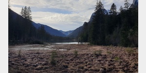
SalzAlpenTour - Ramsauer Schattseitweg
Tour / hiking / bike / ski / Hiking
SalzAlpenTour - Ramsauer Schattseitweg
Length: 15.73 km
Highest point: 1006 m
Lowest point: 628 m
ADDRESS
83486 Ramsau bei Berchtesgaden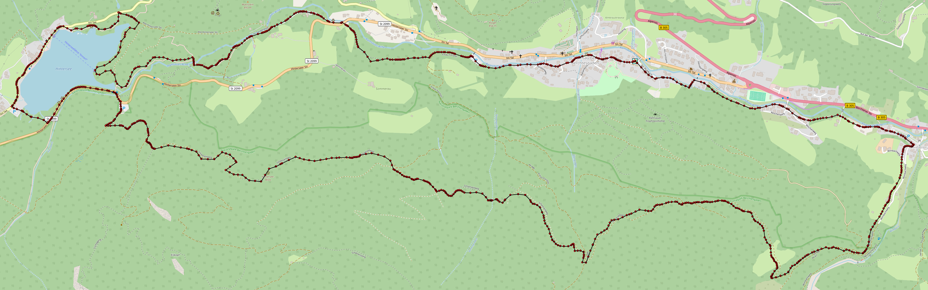
Click for interactive map
..
Images from Poi and starting point surroundings
Videos about the starting point
.

Routes and books with this POI
TOPZIEL - Die deutsche Alpenstrasse
.
Things worth seeing around the starting point
Bergsteigercafe
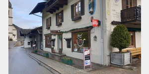 große Auswahl an Kuchen
[ click for more information ]
SalzAlpenSteig 9, Ramsau - Königssee
SalzAlpenSteig The hiking trail leads over 233 km from Lake Chiemsee to the Dachstein.[ click for more information ]
Kalvarienbergkapelle
In the open aedicule is the life-size Crucifixion group.[ click for more information ]
Kreuzweg Ramsau
The Way of the Cross connects the Calvary Chapel with the pilgrimage church of the Assumption of the Virgin Mary, Kunterweg Church, over a length of 600 m[ click for more information ]
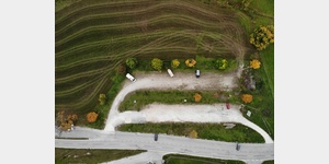
Parkplatz
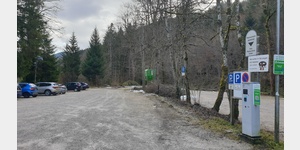 Gebührenpflichtig, Übernachten verboten
[ click for more information ]
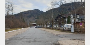
Parkplatz Schwarzeckerstraße 58
 with a great view of the Alps
[ click for more information ]
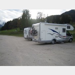
Parkplatz
 Parking lot opposite a pension
usable January - December
[ click for more information ]
Wallfahrtskirche Maria Himmelfahrt
Maria Kunterweg, Maria Kunterweg is a Roman Catholic, listed pilgrimage church in the Rococo style and belongs as a branch church to the parish in Ramsau near Berchtesgaden[ click for more information ]
bergbahn
Hirscheck chairlift Cusor is located at the valley station, Schwarzecker Straße 80, 83486 Ramsau near Berchtesgaden, Germany[ click for more information ]
Wimbachbrücke
 83486 Ramsau near Berchtesgaden Rot Heben
 [ click for more information ]
WC Parkplatz
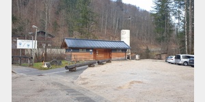 neues WC Gebäude
[ click for more information ]
Ramsau bei Berchtesgaden
Ramsau bei Berchtesgaden ist eine Gemeinde im Landkreis Berchtesgadener Land in Bayern, Deutschland.[ click for more information ]
Pfaffenbichel
Pfaffenbichel 1428 m[ click for more information ]
SalzAlpenTour - Kühroint - Archenkanzel - Schönau
SalzAlpenTour - Kühroint - Archenkanzel - Schönau Length: 13.08 km Highest point: 1417 m Lowest point: 764 m[ click for more information ]
 Hintersee.
 [ click for more information ]
SalzAlpenTour - Rund um den Götschenkopf - Bischofswiesen
SalzAlpenTour - Rund um den Götschenkopf - Bischofswiesen Die SalzAlpentouren sind zertifizierte Premiumwanderwege am SalzAlpensteig.[ click for more information ]
Copyright © 2023 - meinwomobuch.com
listed in the mobile home parking space database of meinwomo
listed in the mobile home parking space database of meinwomo