MEINWOMO-maps (soseasy app for Android, otherwise online on every desktop computer) is the most comprehensive software for mobile home drivers that is available on the market. Nobody even comes close to the range of performance and stability, which is why there are 3 performance levels, because not everyone needs the full performance. You can see this clearly in the videos and you can see the various options.
Scope
With around 1,800,000 locations checked by moderators, such as motorhome parking spaces, campsites, car parks, service points, landscape descriptions, gas stations, shops, bakers, butchers, LPG, supermarkets, shopping malls, museums and much more in 54 countries, well over 600,000 comments, over 350,000 pictures, meinwomo is the largest and most up-to-date database for mobile home drivers on the web.
The Software
The MEINWOMO-maps software is computer-independent, runs on almost all platforms and is also part of the Android app. The parking space app is automatically updated every time it is started with the latest data, which the portal receives and checks every day. This process is extremely fast because only changed data is transferred due to an optimization process. This means that NO app update is necessary for Android either, because the software updates automatically with the data.
What device is required
Since the MEINWOMOmaps software was programmed independently of a computer, it can theoretically be used on any platform in any browser if the browser has a web database, which 90% of browsers have. Exceptions are special anonymous browsers or browsers with compression methods. It is therefore also possible to use the app as a browser app online under iOS and Linux.
Can I try the Easy subscription
YES, after an initial installation, each user has the scope of the Easy license for 10 days to test all basic functions. MEINWOMOmaps then switches to free mode with advertising
AndroidApp
The ultimate motorhome app from the largest motorhome portal in Europe, which many satisfied campers have been using on the portal for over 10 years, has also been available as an Android app SOSeasy since 2020.
MINIMUM REQUIREMENTS is Android 5 and location and storage permissions
The app is available in the Playstore, but can also be downloaded and installed simply by clicking on the graphic on the right. To do this, you must allow the installation of a third-party source. After installation, you can choose to forbid it again. After that, a login window appears and anyone who does not yet have user access can register. When registering, all you need is an e-mail address, to which a link is then sent that you have to click on to set yourself free. The app then asks for authorization for location (location) and storage (offline use), which of course must be allowed for proper use. Please note that this must be allowed in the Android settings! The installation then takes place fully automatically and you can see the map with the current location.
Now you can start using the functions of the Easy subscription for 10 days free of charge and upgrade at any time if necessary.
Who can use it
Everyone who is registered with MEINWOMO. Due to data protection, only a registration with a valid email address is required.
Offline use without internet access
Of course, MEINWOMO-maps can also (except in the free version) be fully offline-capable, i.e. used on the go without internet access. But this only works if you use MEINWOMO-maps in the Android app, because we can only save the data on the device here. With the fast, fully automatic basic installation, the basic data of ALL courses are immediately available. With a license you can (depending on the license) load all detailed data and images for selected places or map areas.
Once loaded, detailed data of places are always automatically updated with each start, reloading is not necessary. Thanks to the optimized loading process, only the changes are loaded extremely quickly.
Is there a free use
If none of the possible licenses are booked after the free 10-day test period with the Easy license has expired, the app can also be used free of charge for a limited time. So nothing has to be paid, but cooperation is expected. Therefore, 2-5 points per month are deducted, which you have to replenish through participation (ratings, comments, sending pictures).
Here, however, all additional functions are switched off and advertising is displayed. You can then only use the card. There is no offline use, no filter and no other additional functions.
You see the places on the map, you can click on a place and then you get an online display of the place with selected pictures, the most important comments and advertisements.
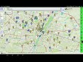
Interactive map with 2039525 POIs
POIs (places) = legal parking spaces, campsites, usable parking spaces, service points, sights, museums, shopping facilities, landscape pictures, loadable routes for hiking, cycling or traveling with a mobile home, restaurants, banks, doctors and much more. . .
total comments 708227
seit gestern 110
New places since yesterday: 51
Image database with 378327 pictures
2193 picture galleries
New pictures since yesterday 39
Discussion and support forum
7687 Videos linked to pois and places
MeinWomo library with 5160 Routes, tourist guides, campsite guides
135252 registered users in the portal
Neu gestern 5, New today so far 0
license free trial area/check it out
Pitches/campsites
Only the normal saved pages with advertising are shown within MEINWOMOmaps. These pages are always updated after a change, but only contain selected comments, a maximum of 5 pictures and no contact details.
Other pois (locations)
Here, too, only the saved pages with advertising are shown. In MEINWOMOmaps you can only use important POI areas.
Additional functions
Additional functions such as transfer of coordinates to a navigation system, distance calculation and much more exclusively with a license.
Easy, the holiday license for everyone
How to get an easy license
Anyone who has collected enough points through participation can book the license free of charge for 250 points. (Menu: User status/book license). Otherwise you can buy an automatically updating subscription or a 12, 24 or 36 month license from an external shop.
Pitches/campsites
These are shown in a window with all the data and images within the map. There are many additional functions such as:
* a satellite map
* Street view (if available at this point),
* Zoomable detailed maps, with many additional functions
* Possibly linked videos
* Current status (open/closed)
* Favorites button
* Nearby places
* Weather at this location
* Coordinates to a navigation app including GoogleMaps navigation
Parking space filter
If you don't always want to see everything on the map, you can use the parking space filter, which has the following functions:
* Selection by course types
* Selection according to equipment
* Opening hours and prices
* Location and surroundings
* Optionally only the favorites or nothing at all are shown
Multiple settings can be saved.
Other pois (locations)
These are also shown in a window within the map with many additional functions such as:
* Satellite map
* Street view (if available at this point)
* Possibly linked videos
* Favorites button
* Nearby places
* Weather at this location
* Coordinates to a navigation app including GoogleMaps navigation
Favorites
Each place or POI has a star button to add it to your favourites. These places/POIs can then be seen on the map with a red border. A list of favorites is only available as a premium user.
Visit reports and images
Each place or POI has a button for comment and notification of visit, as well as a button for sending pictures. There is also a button for your own pictures and comments. Visited places are shown on the map with a blue border.
Environment List
for each place or POI there is a button for the surrounding places. So you can quickly see which service points, sights, shopping opportunities and much more there are around this place or POI. By clicking on an entry, the map jumps to it and shows the entry.
Download for offline use
This is generally only possible if you use MEINWOMOmaps in the Android app, because only then is unlimited storage space available (only limited by the storage capacity of the device). If you use MEINWOMOmaps in the browser (without APP), no download is possible.
* Download EU maps to Zoom11
* You can manually set the memory depth up to which map tiles used online are also saved offline.
* The basic data of all pitches and campsites are automatically offline
* If details of such a place are clicked on online, they are also available offline
* Parking pois can optionally be loaded offline by country
Choose map type for each zoom level
In the small license, the maps are fixed for each zoom level, with an OSM (openStreetmap) map being used up to zoom 15, the Google map being used for zoom 16 and Google Hybrid, i.e. a labeled satellite map, being used for zoom 17 and 18.
Premium, the license for the demanding user
Everything specifically NOT described here is available as in the smaller licenses. This only describes what the premium access can do in addition.
How to get a premium license
If you have enough collaboration points, you can book the license free of charge for 350 points. Otherwise, you can buy an automatically updating subscription or a 12-month license from an external shop. (Menu: User status/book license)
Pitches/campsites
like EasyLicense, additionally:
* Route from location to this place
* free private commentary on the place
Parking space filter
If you don't always want to see everything on the map, you can use the parking space filter, which has the following functions:
* Selection by course types
* Selection according to equipment
* Opening hours and prices
* Location and surroundings
* Optionally only the favorites or nothing at all are shown
Multiple settings can be saved.
Visit reports and images
Each place or POI has a button for comment and notification of visit, as well as a button for sending pictures. There is also a button for your own pictures and comments. Visited places are shown on the map with a blue border.
Environment List
for each place or POI there is a button for the surrounding places. So you can quickly see which service points, sights, shopping opportunities and much more there are around this square or POI. By clicking on an entry, the map jumps to it and shows the entry
Crosshairs
With a small button on the left edge of the map, you can get a movable crosshair on the map, which has functions at the point where the crosshair is currently located on the map
* Determine address at this point
* Give this point to a navigation program
* Quickroute from this point
* Locations around this point
Quickroute
With the quick route you can click on 2 points on the map and the route to be driven is displayed graphically on the map with the total distance. Each place or POI has a button with which you can get a direct quick route from the location to this place or POI with a click.
Route planner
With the route planner (Route-lite) you can create a complete travel route and integrate the places and POIs directly as points in the route. You can also define any free points. Optionally, the route is only connected with direct lines or you can have the real route calculated between all points. The result is available as a list or as a graphic line, directly visible on the map.
Private pois
With this function you can create your own places on the map, both graphically as a symbol and as an entry in a list of your own private places
Download for offline use
This is generally only possible if you use MEINWOMOmaps in the Android app, because only then is unlimited storage space available (only limited by the storage capacity of the device). If you use MEINWOMOmaps in the browser (i.e. without an APP), no download is possible.
* Download EU maps to Zoom12
* Grid manager for loading all detailed data including comments and images for pitches and campsites in a grid system, so that you only have to load where you are going.
* Everything that has been loaded is automatically updated every time it is started
XXL, the license for professionals and frequent travelers
Everything NOT specifically described here is available as in the smaller licenses. This only describes what the PremiumXXL license can also do.
How to get a premium license
If you have enough cooperation points, you can book the license free of charge for 900 points. Otherwise, you can purchase an automatically updating subscription or a 12-month license from an external shop as a one-off purchase or as an extension license within the term. (Menu: User status/Book license)
Other POIs (places)
Normally, when the [P] key is switched on, you only see one type of POI on the right, e.g. parking lots OR points of interest or something else. As an XXL user, you can theoretically turn them all on at the same time and see everything interesting directly on the map. Thanks to an automatic optimization function, moving around the map is still lightning fast.
Favorites
An XXL user can create any number of favorites lists here. All entries in a selected list are shown on the map with a red frame and when you click on an entry the map jumps there.
Crosshair
With a small button on the left side of the map you can get a movable crosshair on the map, which has functions at the point where the crosshair is currently located on the map
* Find the address here
* Give this point to a navigation program
* Quickroute from this point
* Locations around this point
Map magnifier
You have the option to create a second card in the map. This can be a magnifying glass or an overview map. This means, for example, when using the crosshairs you can see the current point, both in the main map and, for example, in one of the 4 corner points of the map in a magnifying glass as a satellite map, or in a Europe overview.
Private poilists
As an extension of the private pois, you can create as many private poilists as you want and you can import third-party POIs, places that you have in the format of a navigation list (csv format), into a list. Various graphic symbols for the map are available for the individual lists.
Tour planner
This is a large, extremely comprehensive travel planner with which you can even create a travel book. Many authors have also used this program to create finished travel books or public travel routes on the portal. It would be too extensive to describe the scope here, so just a brief overview
* Create a travel route over any location on the map
* optionally route points or interesting alternative points that are not on the route
* many manipulation functions to change the route
* Display finished route as HTML book
Navigation
With the location button you only get the current rough location. The navigation module, which is specifically designed for mobile devices with a GPS chip, runs automatic location determination in the background using satellites, so that you have an optimal, precise location at all times. Alternatively, you can also let this run automatically, so that you always have your current location in the middle of the map while driving, meaning the map runs automatically. You can also record this route. With the map you can always see what places, sights, services (water points, washing stations, etc.), shopping opportunities and much more are available.
Free configuration
For professional users, there are a huge number of esw commands that you can submit in the search bar. This allows you to configure the entire system to suit your own needs.
Select map type for each zoom level
You can choose your own map type for each zoom level from a large number of available maps. This also includes Google maps, satellite maps and outdoor maps. When you change the zoom level, you automatically switch to the selected map type.
Shortcuts
You can assign any commands, addresses, etc. to .-commands, so that, for example, you always jump to Munich with .m. You can basically automate ANYTHING you can enter in the search bar at the top with a shortcut. An unlimited number of such commands are possible. You can get a list of all current commands
Download for offline use
This is generally only possible if you use MEINWOMOmaps in the Android app because only there is unlimited storage space available (only limited by the device's memory). If you use MEINWOMOmaps in the browser (i.e. without the APP), no download is possible.
* Download EU maps up to Zoom14 through special configuration (esw command)
* Download all up to almost 2 million Pois (places) by Poi area, category and or country
 MEINWOMO-maps (in Android as SOSeasy app)