Slootdorp Netherlands
Europe´s bigest motorhome-portal
from motorhome drivers for motorhome driver
start
Slootdorp, Information and images
- With the completion of the final dike, it was possible to wrest land from the IJsselmeer.. <9> The first was the polder ´Wieringermeer´ with a size of 20,000 hectares. <9> It is hard to see today that the North Sea was here 100 years ago.. <9> <9> <1001> online Indo Wieringeermeer}
1419962 - The Oever is located 18 km from Den Helder at the southwestern end of the final dike in the province of North Holland.. <9> It is a small village with about 2500 inhabitants <9> <9> <994/1327518> <994/1327519> <994/1327520> <9> <9> Worth knowing <9> <9> De Oever means open water.. The village lies on a former water area between the Wadden Sea and the former Zuidersee.. <9> In the course of centuries of sedimentation, the situation shifted further and further to the east, creating arable land on the northeastern edge of the island of Wieringen.. <9> This country took the name of the former water area ´De Oever´ and settled here in the 14th and 15th century.. People.. In 1929 additional land was gained by ditching.. One can clearly see the difference between ´young´ and ´old´ country.. <9> From Oever, on clear days, you can see the island of Texel, where ferries depart.. <9> <9> Den Oever is located directly on the Dike with its locks (Stevinsluizen) and drainage channels <9> <9> <994/1327521> <994/1217733> <994/1637617> <9> <9> Attractions <9 > * Harbor, Havenkade 1 <9> * Thatched, octagonal windmill <9> * Museum ´Vikinformatiecentrum´ with information about the Viking Age in Holland <9> <9> <1001> <9>
1420315


-
Motorhome place de Tulpentuin
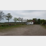
 1774 Slootdorp Noord Holland Netherlands
Pay for use site 14.60 Euro


")
")

open Januar until Dezember


Motorhome place nature campsiteverein Het Bos Roept

 1774NB Slootdorp Netherlands
Pay for use site 22.5 until 26 Euro


open 1.April until 25.Oktober
Motorhome place SVR Minicampsite Onder De Dam
1774NR Slootdorp NetherlandsPay for use site 20 Euro

")

open 1.Januar until 31.Dezember
 Selected parking spaces
 | general parking lot
niederlande 1779 Den Oever
| general parking lotniederlande 1779AV Den Oever
| general parking lotniederlande 1777 Hippolytushoef
 |
| Parkenwander
niederlande 1779 Den Oever
 |
| Parkenwomo8
niederlande 1779 Den Oever
 |
| Parkenwomo
niederlande 1777 Hippolytushoef
Selected sights
 |
| niederlande 1771 Wieringermeer, Wieringerwerf Derk Stevensweg
| niederlande 1773 Wieringermeer, Wieringerwerf
Selected service points
 | Gas exchange
Gastausch
Niederlande 1775RB Hollands Kroon Hoornseweg 23
Opening hours Mon-Fri 9:00-18:00 Sa 9:00-17:00 Gas exchange Dutch gas bottles and camping gas
Opening hours Mon-Fri 9:00-18:00 Sa 9:00-17:00 Gas exchange Dutch gas bottles and camping gas
 | car wash
Havenweg
niederlande 1771 RW Wieringerwerf Havenweg
| car washAutowaschanlage
niederlande 1777 JP Hippolytushoef Koningsweg
motorhome places Slootdorp in these books
General Pois
 | vet
| vetVeterinair Centrum Holland Nord
Niederlande 1775RB Hollands Kroon - Middelmeer Hoornseweg 31
Consultation hours
Mon-Fri 8:30 a.m.-7 p.m.
Sat 9 a.m.-4 p.m.
emergency service 24 hours on 0031-227 58 12 34
Consultation hours
Mon-Fri 8:30 a.m.-7 p.m.
Sat 9 a.m.-4 p.m.
emergency service 24 hours on 0031-227 58 12 34
 | Miscellaneous
 Deka Supermarkt
Niederlande 1775 Hollands Kroon-Middelmeer Brugstraat 43
Opening hours
Mon-Thu 8:00 am - 8:00 pm
Fri 8:00 am - 9:00 pm
Sat 8:00 am - 7:00 pm
Sun 10:00 am - 6:00 pm
Opening hours
Mon-Thu 8:00 am - 8:00 pm
Fri 8:00 am - 9:00 pm
Sat 8:00 am - 7:00 pm
Sun 10:00 am - 6:00 pm
 | dentist
Mondzorg Middenmeer
Niederlande 1775RB Hollands Kroon - Middenmeer Hoornseweg 31
Office hours:
Mon, Wed, Thu, Fri 8:00 a.m. - 5:30 p.m.
Tue 1:00 p.m. - 8:15 p.m.
Sat 8:00 a.m. - 1:00 p.m
Office hours:
Mon, Wed, Thu, Fri 8:00 a.m. - 5:30 p.m.
Tue 1:00 p.m. - 8:15 p.m.
Sat 8:00 a.m. - 1:00 p.m
 | Bakery
Bakkerij Slijkerman
Niederlande 1775BC Hollands Kroon Brugstraat
Opening hours:
Mon-Fri 8:00 am - 6:00 pm
Sat 8:00 am - 4:00 pm
Sun closed
Opening hours:
Mon-Fri 8:00 am - 6:00 pm
Sat 8:00 am - 4:00 pm
Sun closed
 | Avia
Avia
Niederlande 1775BD Hollands Kroon Brugstraat 65
2211427_Beschreibung
2211427_Beschreibung